
Smart flying cameras
senseFly SA

Incorporated
30.11.2009Headquarters
Cheseaux-LausanneSupport


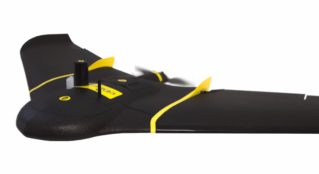
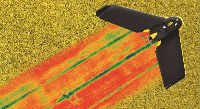
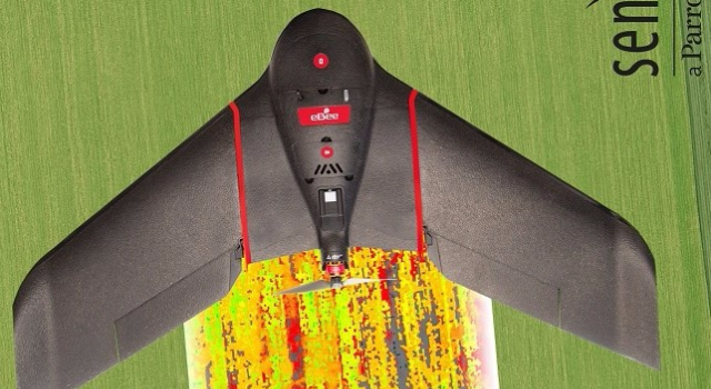
senseFly produces smart autonomous flying cameras that can automatically survey a zone of up to 10 square kilometers in a single flight while recording high-resolution aerial images. Such images are transformed into precise and up-to-date maps that provide great added value to surveyors, mining sites managers, farmers or land managers in their decision-making process.
News
AgEagle to Acquire senseFly from Parrot (startupticker.ch)
SenseFly to leverage AirMap’s flight planning tools (startupticker.ch)
SenseFly receives first Swiss approval for beyond line of sight flights (startupticker.ch)
Startups among Switzerland’s flagbearers of the European Business Awards (startupticker.ch)
SenseFly’s lightweight quadcopter ready for take-off (startupticker.ch)
eXom, the next-generation rotary drone (startupticker.ch)
Swiss Economic Award: Die Finalisten 2014 sind bekannt (startupticker.ch)
senseFly and EPFL Lab awarded euRobotics TechTransfer Award (startupticker.ch)
senseFly joins the Parrot Group (startupticker.ch)
Milestones news
Documents
Videos and Presentations
Discover senseFly’s new video and enjoy the adventure of mapping
eBee Ag, the drone for precision agriculture
Mapping the impossible
New eBee
New product video